Uncovering the Best Waypointer Alternative for Your GPS Needs
Waypointer is a valuable service for POI (Points of Interest) search and management, particularly useful for tourists and GPS device owners. It allows you to find POIs on a map, filter them by categories like springs or camping sites, and plan your next journey. Waypointer also facilitates sharing POIs with friends and embedding maps with POIs on other pages. However, for various reasons – be it specific feature requirements, platform compatibility, or simply seeking a different user experience – many users look for a reliable Waypointer alternative. This article explores some of the top contenders that can fulfill your GPS and POI management needs.
Top Waypointer Alternatives
Whether you're an avid hiker, a keen cyclist, or simply someone who loves to explore, finding the right tool to manage your GPS data and points of interest is crucial. Here are some excellent alternatives to Waypointer, each offering unique strengths for different users.

GPXSee
GPXSee is a powerful, free, and open-source GPS log file viewer and analyzer that supports GPX, TCX, KML, FIT, IGC, and NMEA files. Available on Mac, Windows, and Linux, its Google Maps integration makes it an excellent Waypointer alternative for those who need to view and analyze their GPS tracks with detailed map overlays.

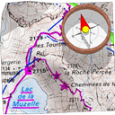
OruxMaps
OruxMaps is a free online/offline map viewer and track logger specifically designed for Android devices. Ideal for outdoor activities like running, trekking, and mountain biking, it supports KML and GPX import/export, offers offline map support, allows you to save your tracks, and crucially, manages points of interest (POI). This makes it a robust Waypointer alternative for Android users who prioritize mobile outdoor navigation.
MyTrails
MyTrails offers comprehensive offline and online trail maps for Android, making it a strong Waypointer alternative for adventurers. Its full-screen trail map, oriented with a built-in compass, provides clear direction. Features like adding GPS location to photo metadata, journey review, and support for cycling and other sports activities make it a versatile freemium option for mobile users.

Garmin Connect
Garmin Connect is a free, community-based website and app (Android, iPhone, Windows Phone) for athletes who track activities with Garmin devices. While more focused on activity tracking, its features like automatic cycling tracking, running metrics, and GPS distance measurement make it a relevant Waypointer alternative for those integrated into the Garmin ecosystem and looking for activity-centric POI management.

rubiTrack
rubiTrack is a commercial activity tracking software exclusively for Mac. It's designed for displaying, analyzing, organizing, and storing various activities like runs, bike rides, and hikes. With features specific to cycling, it serves as a robust Waypointer alternative for Mac users who need detailed analysis of their GPS-tracked activities and associated POIs.
Geo Tracker
Geo Tracker is a fast and simple freemium app for recording GPS tracks, available on Android and Android Tablet. It's particularly appealing to fans of action sports and long-distance travel. Its primary feature is tracking activities, making it a straightforward Waypointer alternative for users who prioritize reliable GPS track recording and basic POI association.

TrailRunner
TrailRunner is a free route planning software for Mac, catering to long-distance sports like biking, hiking, inline-skating, and skiing. It includes calculators for various activities such as jogging, triathlon, and cycling. This makes it a compelling Waypointer alternative for Mac users who need dedicated route planning and analysis for their outdoor adventures.

EveryTrail
EveryTrail is a freemium platform (Web, Windows Mobile, Android, iPhone, Blackberry) designed for tracking, sharing, and exploring trips. Users can track their journeys, take photos, and add their stories, then share them easily. While it lacks specific features listed for Waypointer, its core functionality of trip tracking and sharing makes it a viable Waypointer alternative for social explorers.

GPSLogLabs
GPSLogLabs is a free web-based service that allows you to map and graph various activities like running, riding, and hiking. Its focus on visualizing and analyzing logged GPS data makes it a straightforward Waypointer alternative for users who prefer a web interface for managing their activity logs and associated geographical data.
Ultimately, the best Waypointer alternative for you will depend on your specific needs, preferred platform, and desired features. Whether you prioritize detailed analysis, offline capabilities, community sharing, or a simple tracking experience, there's a powerful tool out there to help you manage your POIs and explore the world.