Uncovering the Best GeoFlow Alternatives for 3D Data Visualization
Project codename "GeoFlow" was a groundbreaking tool launched in 2013, designed to revolutionize how users interacted with data. By enabling powerful 3D visualization on Bing Maps, GeoFlow allowed for discoveries in data that traditional 2D tables and charts often missed. Users could plot up to a million rows of data, view changes over time in a geographic space, and share insights through cinematic tours. However, as technology evolves, many seek a robust GeoFlow alternative to continue their advanced data exploration and visualization needs. This article explores the top replacements for this innovative software.
Top GeoFlow Alternatives
If you're looking for a powerful GeoFlow alternative to visualize your data in engaging 3D or geographic contexts, these options offer similar functionalities with diverse strengths, ranging from open-source flexibility to rich feature sets.
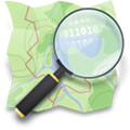
OpenStreetMap
OpenStreetMap (OSM) is a powerful, free, and open-source web-based collaborative project to create a free editable map of the world. As a community-based platform with an open API, it allows for user-generated data, making it a flexible GeoFlow alternative for those who need highly customizable and crowdsourced map data.

Leaflet
Leaflet is a modern, open-source JavaScript library primarily designed for mobile-friendly interactive maps. It's a self-hosted solution that can be built upon OpenStreetMap data, providing a lightweight yet robust GeoFlow alternative for developers needing to integrate custom mapping and visualization directly into web applications, including support for offline maps.
Marble
Marble is a free, open-source Virtual Globe and World Atlas available on Mac, Windows, Linux, and as a PortableApps.com version. It allows users to pan, zoom, look up places and roads, and select various map data resources. Its ability to support apps with offline map support and provide turn-by-turn navigation makes it a versatile GeoFlow alternative, especially for desktop-based geographic exploration.

NASA World Wind
NASA World Wind is a free, open-source virtual globe available for Mac, Windows, and Linux. It allows users to zoom from satellite altitude into any place on Earth, leveraging Landsat satellite imagery and Shuttle Radar Topography Mission data. With features like image upscaling and navigation, it stands as a powerful GeoFlow alternative for scientific visualization and detailed earth observation.

Wikimapia
WikiMapia is a free, web-based online map and satellite imaging resource that combines Google Maps with a wiki system. This allows users to add information in the form of notes and boundaries. While not a direct 3D visualization tool, its mapping and wiki features make it an interesting GeoFlow alternative for collaborative geographic data enrichment.

TransforMap
TransforMap is a free, open-source web platform working towards visualizing alternatives to dominant economic thinking on a single mapping system. Built on OpenStreetMap, it serves as a specialized GeoFlow alternative for those interested in mapping and visualizing social and economic initiatives in a geographic context.

Modest Maps
Modest Maps is a small, extensible, and free open-source library for designers and developers to create interactive maps in their projects. Available on Mac, Windows, and Linux, it provides a core set of features and can support apps with offline map support, often based on OpenStreetMap. This makes it a suitable GeoFlow alternative for custom web mapping development.

GMap.NET
GMap.NET is a powerful, free, cross-platform, open-source .NET control that enables the use of routing, geocoding, directions, and maps from various providers like Google, Yahoo!, and Bing. Available for Windows and Windows Mobile, it supports offline maps and is based on OpenStreetMap, offering a robust, standalone GeoFlow alternative for .NET developers.
RMaps
RMaps is a free, open-source Android navigation tool that functions as both an online map viewer for popular maps and an offline map viewer for user-created maps. Based on OpenStreetMap and supporting offline maps, it's a strong GeoFlow alternative for mobile users needing flexible and customizable map navigation and data viewing on the go.
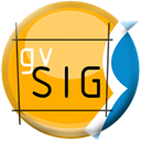
gvSIG
gvSIG Mini Maps is a free, open-source application available across Mac, Windows, Linux, Android, and Android Tablet. It allows users to browse and navigate with GPS using a full set of free online and offline maps. With a modular system, support for offline maps, and points of interest (POI), and being based on OpenStreetMap, gvSIG is a comprehensive GeoFlow alternative for a wide range of devices and mapping needs.
Each of these GeoFlow alternative options offers unique strengths, from open-source flexibility and customization to specific platform support and feature sets. Whether you're a developer, a data analyst, or simply a mapping enthusiast, exploring these alternatives will help you find the best fit for your 3D data visualization and geographic exploration needs.